Rylstone Station 5

Rylstone Railway Station


Photo: Kandos High year 9 history project in 1976.

Rear-view of the station with 2 horse and carriages, 6 workmen, 3 townspeople.
Ref: Transcript of the presentation by a Kandos High year 9 history student in 1976.

Rylstone Church


Photo: Kandos High year 9 history project in 1976.

Kandos Old School

Kandos Old School


Photo: Kandos High year 9 history project in 1976.

Rylstone Old School

Public School Rylstone


Photo: Kandos High year 9 history project in 1976.

Rylstone Station 4

Rylstone Railway Statiom


Photo: Kandos High year 9 history project in 1976.

Kandos Coop 3

Kandos Coop Staff


Photo: Kandos High year 9 history project in 1976.

Rylstone Main Street 4


Photo: Kandos High year 9 history project in 1976.

Rylstone Station 3

Rylstone Railway Station


Photo: Kandos High year 9 history project in 1976.

Rear-view of the Railway Station. The weatherboard construction can be seen well. A horse and carriage and three other persons are waiting for the train.
Ref: Transcript of the presentation by a Kandos High year 9 history student in 1976.

Tyldesley - the village that disappeared

Pictured is water bailer, Harry McAlpine, colliery engineer, James Wilson and the colliery dog Rex at Tyldesley in the early 1950s. Harry and his wife Annie also ran the post office and general store at Tyldesley.


Between 1888 and 1960 the area around Cullen Bullen hosted six underground coal mines, including Tyldesley Colliery which ceased operation in 1960. The village was largely abandoned by the mid 1960s and has all but disappeared from the landscape.
Ref: HERITAGE - Newsletter of BMACHO, Nov-Dec 2009

Bogie Farm

Bogie Farm


Photo: RAHS, Frank Walker collection

Bogie Farm (sic) near Rylestone (sic), granted to Samual Marsden.
Ref: RAHS

Photo taken looking East.
In the centre is the original homestead of Pili Slab with an addition in Fibro.
To the right (partly hidden by the large tree) is a Machinery Shed, Blacksmith Shop, Cow Bail & yards.
Further to the right and further away is the Shearing Shed & Hayshed.
Going to the left of the homestead can be seen the Meat Room and then in front of a small tree is the grave of Emily Ash, 3 months old from memory.
Then to the far left (just in the photo) are the Shearers Quarters.
Behind the homestead is a sandstone floor/slab (iron bark) Garage with shot gun holes in slabs on eastern side where it is said they shot the attacking Blacks.
Ref: Gaely Braddock

William Moss & his team - loading wool

William Moss and his team - loading wool

Ferguson, Samuel (1871-1953)


Photo: Shirley Tunnicliff collection

The photo is of Samuel Ferguson and his son Wallace.
I believe the photo is taken near Sammy's Flat, which used to be in front of his house.
Ref: Shirley Ferguson

John Davis (1781-1848) - headstone

John Davis headstone


Photo: KBCM

John died on July 2nd, 1848, and was buried on Dabee Station. 
In 1958, a fallen headstone was resurrected on Dabee, on the northern bank of the creek that runs into the nearby Cudgegong River.
It is made of sandstone, and time has weathered the original inscription. A marble plaque attached when the stone was re-erected reads "Sacred to the Memory of John Davis, who departed this life July 2, 1819. Aged 67 years,"
It seems fairly certain that the date should read 1848, and this stone marks the resting place of the Lincolnshire convict whose descendants settled so many of the properties in the area.
Ref: KBCM document.

William Cox (1764-1837)


Photo: Men of Mark

Children at Rylstone Public School

Children at Rylstone Public School


Photo: Jim Jamison collection

Rylstone cows in the main street.


Photo: Kandos High year 9 history project in 1976.

This is a picture of John Windle’s bullock team. At the left on his horse is John Windle. This photo was taken in front of McKenna’s corner. Far back behind John Windle is the Church of England.
Ref: Transcript of the presentation by a Kandos High year 9 history student in 1976.

Rylstone 4


Photo: Kandos High year 9 history project in 1976.

St Paul's Church of England, Ilford

St Paul's Church of England, Ilford


Photo: Taken before road lowered in 1940's.

CHURCH OF ENGLAND - Built 1876 from stone salvaged elsewhere. Pews donated Mrs Eames, Organ Chair Mrs Hollingsworth, Embroidered Bookmark Phyllis Rearden - Mr and Mrs G Briggs replacement font, 
Ref: Cherry Tree Hill - Heritage Tour brochure.

Kandos Coop Staff 2


Photo: Kandos High year 9 history project in 1976.

Wattle and daub building at Clandulla


An example of one of a number of wattle and daub buildings which still remain in the district.
Ref: MWRC

St. John’s Union Church, Running Stream

St. John's Union Church (Circa 1906)


St. John’s Union Church was opened and dedicated for worship by The Venerable Archdeacon Dunstan of Mudgee on 6th September 1906. It is probable that the photograph above was taken at the opening of the Church.
Ref: “REMINISCENCES” - SAINT JOHN’S UNION CHURCH at Running Stream by Peter & Pru Docker.

Hardwick, John William (1826-1891)


Photo: from Gail Mann

Note on back of photo -
"Copy of a photograph in a family album formerly owned by the late Marion Hardwick.
Now in possession of M.R. Hardwick.
Photo courtesy of Margaret Hardwick, December 1997"

Rylstone Court House


Photo: MWRC collection

The Court House in Louee Street is an example of fine stone masonry work which is a feature of buildings constructed in the Rylstone Shire in the 1800's.

Rylstone Main Street 5-1


Photo: Kandos High year 9 history project in 1976

Close-up of E.H. Nash’s grocery store. It has not changed much and might be recognized by some as the store owned by Mrs Hawkins. 
The tin part of the building to the left is not standing but in its place the Carlton Café.
Ref: Transcript of the presentation by a Kandos High year 9 history student in 1976

Rylstone Main Street 3


Photo: Kandos High year 9 history project in 1976. 

Is a picture of Louee St. On the left of this picture near the Black Cross stands the Globe Hotel. Where the picket fence runs, now stands the Bank of NSW and the Roman Catholic Church. On the right hand side stands a building which has now been demolished. Another house, that of Mrs S . . . . . . ’s, now stands on the site.
The grocery shop of E.H. Nash is still standing, known to all as Mrs Hawkins’ dress
shop. 
Looking down the street is the site of the Rylstone Hotel.
Ref: Transcript of the presentation by a Kandos High year 9 history student in 1976.

Globe Hotel, Rylstone 2


Photo: Kandos High year 9 history project in 1976.
 
Here again we see the Globe Hotel. Notice that the back has had extra rooms added. At the very back area of the hotel we see a group of small buildings which were presumably used as a stable. 
The Globe is still a prominent building in Rylstone although it now differs to what is seen here.  
Ref: Transcript of the presentation by a Kandos High year 9 history student in 1976

Rylstone 3

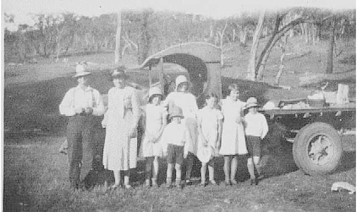
Photo: Judy Valentine collection.

This is Mudgee Street. looking north.
First House is a slab house, still existing to-day. At one time it was a Blacksmith shop owned by Trains.
Next House is Staffs, next Hedingly built by Hardwick, with old store next door then new Store, later to become the Masonic Lodge now privately owned.
Past there is a glimse of James Brown's house then a flour Mill and the Shamrock Hotel.
In the top right hand corner is Charlie Mulholland's dairy. There is still part of the dairy standing to-day.
Ref: Shirley Tunnicliff
 

Jimmy LAMBERT

Jimmy Lambert (Photo: Milne Collection, National Museum of Australia, Canberra)


Jimmy Lambert (date of birth unconfirmed) is pictured here about 1860. He was held in esteem, officiating at the opening of the second Cudgegong Bridge in 1871, after the original bridge was washed away in 1867.

Jimmy died about 1882 and is said to be buried at Aaron's Pass, along with Rachael, one of his granddaughters.

Peggy Lambert

Peggy Lambert


Photo: Milne Collection, National Museum of Australia, Canberra.

 Peggy Lambert (identified as Margaret Kirkness on the death certificate of her daughter Jane Rogers), born around 1830, pictured here about 1860. Peggy died in 1884 and was buried on the day the railway opened in Mudgee. She often expressed a wish to be buried in a tree, according to the native custom, but her last resting place is in an unmarked grave in Rylstone cemetery.

The Franks family picnic at Kandos 1930


Photo: MWRC collection

The people in this photo are from left to right Harry (Henry Charles) Franks, Grace Margaret Franks (née Cosier) then Peg (Ella Ma (Pigram) Madge Isobel Annie, Nellie Grace, Jean Margaret, Doug (Henry Doug) and in front Reginal Harvey Franks.
The truck was bought new in Sydney for 595 pound with no cab or tray. 
Ref: Jenny Franks

Camboon homestead & school

The Camboon homestead and school


Photo: MWRC collection

Photo taken in 1963.
The school is at the right of the photo.

Wedding Group at Warrangee Terrace

Wedding Group at Warrangee Terrace


Photo: Mulholland collection

Marriage of Hannah Moss to Ernest Honeysett on 12 March 1902, held at St. James' Church Rylstone.

Wedding Group at Warrangee Terrace РHome of William and Mary Ann Moss (n̩e Baker).

First Surveyors Store


The first surveyors store was built in what is now Mudgee Street, in the earlt 1850's. Hardwick settled on the site where he built "Hedingley" and Hardwick's first store.
Ref: MWRC collection.

Slapp's Sawmill

Slapp's Sawmil

Pinnacle Swamp School Children


Photo: Shirley Tunnicliff collection

This photo was taken in the 1800's.
L - R Boy in back is Sidney Brown, there are Bisleys also in the photo. The 1st girl in front L - R Elsie Isabella Brown, next to her is Gertrude Brown.
Ref: Shirley Tunnicliff


"Brookside" - Reedy Creek


Photo: Shirley Tinnicliff collection

"Brookside" is at Reedy Creek beside the road and was in the Black Family for a long time, the last being Jim Black, who married Dodie Abbott nee Riches,after her death her Daughter Hazel Marchant and her Ray lived there before selling out and moving to Rylstone.
Ref: Shirley Tunnicliff

Early Dozer


Photo: Shirley Tunnicliff collection.

Bisley's Store - Rylstone

Bisley's Store


Photo: Shirley Tunnicliff collection.
  
Photograph taken circa 1927.
People in this photo are L - R Les Bisley, Lauchie Banks, Eva Hand, Dorothy Tatton and Nevell Bisley.
Ref: Shirley Tunnicliff

Rylstone Showground from the west

Showground from the west

Globe Hotel - Red Cross Carnival

Red Cross Carnival


Photograph taken circa 1942.
The woman in the light dress at the Red Cross tent is Mrs Elsie Mulholland, with her possibly is Mrs Stan McQuiggin.
Ref: Shirley Tunnicliff

Rylstone House 2


Rylstone House
Photo: Kandos High year 9 history project in 1976.


(Same house at difference angle) This is the front of the house. The house either became a Dr’s surgery. The small casks at the right of the house were used as water tanks. This was a primitive method of storing water.
Ref: Transcript of the presentation by a Kandos High year 9 history student in 1976.

Decorated Car, Rylstone


Decorated Car, Rylstone

 Photo: Kandos High year 9 history project in 1976.

This is the first car in Rylstone. The driver was Dr Hansard, who also owned it. 
Ref: Transcript of the presentation by a Kandos High year 9 history student in 1976.

Original Oakwood wing with Tyan Peak behind


Photo: from Trevor Jamison

‘Oakwood’ is in the Capertee Valley, at the end of a dead end valley, at the foot of Mt. Tyan, known locally as Tynan Peak, the highest local mountain. 
Ref: Trevor Jamison

Brighton, Louee Street, Rylstone


Arbour Day

Arbour Day

Rylstone 2


Photo: Kandos High year 9 history project in 1976.

We have here the Tong Bong Creek joins the Cudgegong River. 
And in the left centre of the picture we have the second flower mill that was built in Rylstone and on the far left we have Shamrock’s Hotel or Shamrock’s Inn and a man was killed in the bar of Shamrock’s Inn and he was found about 2 miles along the Bylong Road and so there wasn’t any trouble they made it as if he had fallen off his horse. 
In the centre we have Dr Howe’s house in Mudgee St in early 1860’s.  
Ref: Transcript of the presentation by a Kandos High year 9 history student in 1976.


This photo is taken from the Bylong road looking south. You will notice that the railway hasn't come through yet. In the distance, right top hand corner is Hardwicke's store, below this is James Brown's house in Mudgee Street, coming down to the east is the Shamrock hotel and the Flour Mill. This should be in the late 1800's.  
Ref: Shirley Tunniclif.

Morrison House at Davis Swamp, Rylstone

Morrison House at Davis Swamp, Rylstone

Caroline Baker, Lone Grave on Monivae

Caroline Baker, Lone Grave on Monivae


Photograph: Wal Pilz 2009

Caroline Baker (née Papworth) c.1833-1871

Children at Rylstone Public School